
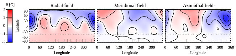
ZDI maps of the radial, meridional, and azimuthal field components of 51 Peg. Contours are shown with a step of 0.5 G. The dotted line corresponds to the lowest visible latitude. The vertical bars at the bottom of each panel show the central longitude of each LBT observation.